Overview
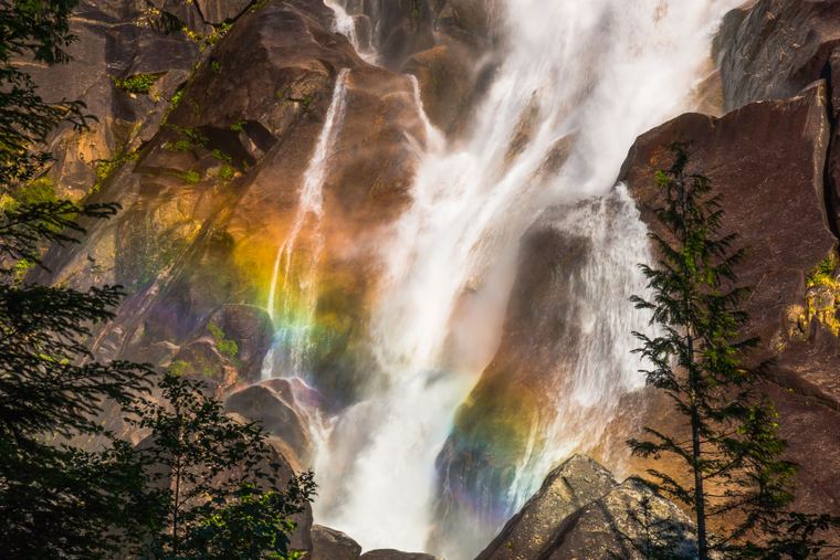
The Rainbow Lake hike climbs from the Rainbow Falls pullout on Alta Lake Road to Rainbow Lake. The Resort Municipality of Whistler gives about 16 km return with roughly 850 m of elevation gain, and says to allow a minimum of 6 hours.
Other guides list net elevation changes between about 790 and 850 m, and note that total climbing is higher because of ups and downs. If you only want the falls, the Rainbow Falls loop is reported at about 2.1 km with about 150 m of gain.
Getting there
Trailhead
Park at the Rainbow Falls pullout along Alta Lake Road.
Other routes
A separate, much longer route starts in the Alpine Meadows subdivision and is listed at about 24 km and 1,080 m of gain. This guide covers the standard Rainbow Falls route.
Check conditions
Check the Resort Municipality of Whistler and Trailforks for current trail conditions.
Know before you go
No dogs
Dogs are not allowed at Rainbow Lake, which is part of Whistler's watershed.
Start early
With a minimum of six hours for the round trip, start early and carry a headlamp.
Total climbing
Net elevation figures understate total climbing because of ups and downs along the route.
Questions
How long is the Rainbow Lake hike?
The Resort Municipality of Whistler gives about 16 km return with roughly 850 m of elevation gain and a minimum of 6 hours.
Where do I park?
At the Rainbow Falls pullout along Alta Lake Road.
Are dogs allowed?
No. Dogs are not allowed at Rainbow Lake because it is part of Whistler's watershed.
Is Rainbow Falls on the way?
Yes, the standard route starts at Rainbow Falls. The falls loop on its own is reported at about 2.1 km with about 150 m of gain.
Safety checklist
Tell someone your plan
Leave your route, group size and expected return time with someone you trust, and check in when you are back. BC AdventureSmart (adventuresmart.ca) has a free trip-plan form.
Check conditions the same day
Look at the weather, road and trail conditions, closures and (in snow season) the avalanche forecast on the day you go, not last week. Use the land manager's page for this guide.
Set a turnaround time
Pick a time to turn back whatever happens, start early, and carry a headlamp. Most trips go wrong in the last hours of the day.
Carry the essentials
Water, food, navigation (map and offline GPS), light, first aid, extra layers, sun protection, a whistle and fire or shelter. A phone alone is not a plan.
Emergencies
Call 911. Cell coverage is unreliable or absent in much of the Sea to Sky backcountry, so consider a satellite messenger and know your location.
Water and wildlife
Wear a life jacket on the water: cold water can disable you in minutes. Carry bear spray where bears are present, keep food secured and give wildlife space.
Sources & disclaimer
This guide draws on Resort Municipality of Whistler: Alpine Trail Program; Vancouver Trails; Outdoor Vancouver; 10Adventures.
Last checked November 18, 2026. Figures marked ≈ are approximate, and sources sometimes disagree. Always confirm with the land manager before you go.
Outdoor recreation involves risk, including serious injury and death. This guide is general information compiled from the public sources listed above and was last checked on November 18, 2026. Conditions, access, closures, fees and rules change, and some figures differ between sources. It is not a substitute for current information from the land manager, for proper skills, equipment and preparation, or for your own judgment. You are responsible for your own safety and decisions. To the extent permitted by law, Sea to Sky Trails and its authors accept no liability for loss, injury or damage arising from use of this guide.